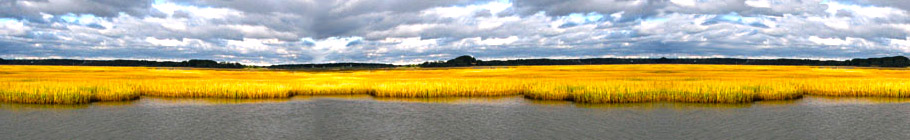
Site Guide to Allegheny County's Portions of the Allegheny, Monongahela and Ohio Rivers
Submitted by Scott Kinzey
The famous rivers of Pittsburgh and Allegheny County offer rewarding birding. Near McKeesport, the Youghiogheny flows into the Monongahela. The Ohio River begins at the confluence of the Allegheny and Monongahela at the point in Pittsburgh. In the last few years I have become familiar with the lower Allegheny, the lower Monongahela, and Pennsylvania's portion of the Ohio. From more than 50 places I have found to look for birds along the rivers, I will describe a selection of the best sites chosen for their variety of coverage area, accessibility, and good birding views.
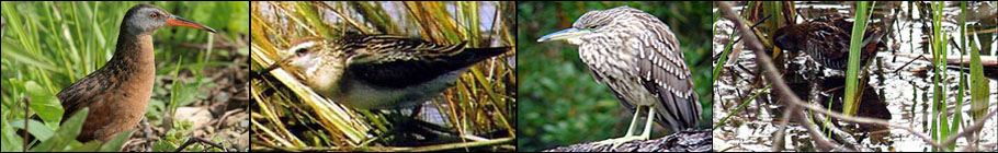
These large rivers do not concentrate waterfowl as do other western Pennsylvania waterways such as Lake Arthur in Butler County, Yellow Creek Lake in Indiana County, Pymatuning Lake in Crawford County, and Presque Isle State Park on Lake Erie. For example, you can see hundreds of Ruddy Ducks at Lake Arthur in November, but if you find ten on the rivers you are doing better than average. Nevertheless, the list of waterbirds recorded each year on the rivers is comparable to the variety at the region's lakes, though an entire season would be necessary to see as many species as you could see in one day at the places mentioned above. Locally uncommon species reported on Allegheny County rivers in recent years include Bald Eagle, Osprey, Black-headed, Great Black-backed, and Lesser Black-backed Gulls, Black-crowned Night-Heron, Great Egret, Caspian Tern, Forster's Tern, American White Pelican, Long-tailed Duck, and all three Scoters. A female Harlequin Duck was seen by many observers at Western Penitentiary on the Ohio.
A few birds are around during summer, but the birding season on the rivers really begins in late September when the first migrants arrive like Pied-billed Grebes and Ruddy Ducks. By late-October more waterfowl and gulls appear. Most of the gulls are Ring-billed with a smaller number of Herrings and even fewer Bonaparte's. November is best for seeing loons, grebes and the greatest variety of waterfowl and gulls. Any species from the list of common Pennsylvania waterfowl is possible. Tundra Swans migrate through Allegheny County during November, but the vast majority are flyovers and are not commonly seen on the water. On Thanksgiving Day 1999, Tundra Swans were "put down" by weather on sites across southwestern Pennsylvania including the Allegheny River at Verona, where 180 were found along with Buffleheads, Ruddy Ducks, and a drake Long-tailed Duck.
Numbers of wintering waterfowl may have declined on Allegheny County's rivers during the last quarter century. I have heard accounts that large rafts of wintering Canvasbacks and Common Goldeneyes were found annually in decades past. Local birders Jack and Sue Solomon recall seeing more of other species such as Hooded Merganser. Large wintering flocks of waterfowl have been notably absent in recent years except Mallards, Canada Geese, and domestic ducks and geese. The reason for the absence of large wintering flocks is not clear. It will be an interesting subject for further research.
Birding does get slow in the true winter months of January and February. A few stragglers remain along with late arrivals like Common Merganser and Common Goldeneye. No large flocks of these species have been noted in the last few winters. Gull numbers vary from year to year. A few hundred gulls can usually be found each winter recently. In the winter of 1999/2000 hundreds could be seen in the Pittsburgh area from mid-October through late February. It is hard to estimate how many gulls winter here because they are so scattered and mobile. Wintering Great Blue Herons perch in riverside trees. I have seen more than 15 at a time in communal roosting areas from December through February. They tend to use the same areas each winter.
Birding improves in March when northbound waterfowl are in the peak of migration. April features the late waterfowl and gulls plus the chance for a tern or uncommon wading bird. I have seen flocks of Bonaparte's Gulls numbering in the dozens and 3 Great Egrets in April 2000. My only local sighting of a Black-crowned Night-Heron was in April 1998. Hundreds or perhaps a few thousand Double-crested Cormorants have gathered on the rivers in spring in the last few years or more. The first birds arrive in March. The number peaks in mid-April and then trickles off through May. Large, leafless trees and especially around the islands are where to look for these roosts, which are most reliable in the evening. I have seen over 200 in one tree. A few cormorants remain during summer, but nesting has not been detected. I have seen only a fraction of the spring numbers in fall with the peak in October.
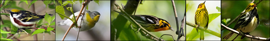
By mid-May recreational boating increases which makes observation more difficult. If you visit the rivers during the summer, try early in the morning (Byrom 1975). Canada Geese and Mallards are abundant and are the only waterfowl that breed here. Belted Kingfishers are usually easy to find, even in the recent mild winters. I am not sure if nesting has been confirmed, but I did see nesting evidence on the Ohio River in Beaver County a few years ago. Northern Rough-winged Swallow is another common breeder. Spotted Sandpipers are present through summer and may breed as well. Common land birds along the riverbanks include Warbling Vireo, Yellow Warbler, Gray Catbird, Baltimore Oriole and Song Sparrow. Turkey Vultures are commonly seen from the river valleys. Common Nighthawks are common breeders in the river towns and are seen from all points along the rivers. Beginning around mid-August they can be seen in the hundreds as they gather during migration. Evenings, especially in the latter half of August.
The most unique breeding bird to our rivers is the Herring Gull. In 1994, Herring Gulls nested on a navigational structure close to the Highland Park Bridge on the Allegheny River -- the first confirmed breeding of any gull species in Pennsylvania (Floyd 1994). It remained the only breeding colony until another site was found in Erie County in 1998 (McWilliams 1999). Herring Gulls have nested each year at the bridge, and the colony has grown to more than 25 birds. They travel some distance from the bridge daily, but a few can usually be found there anytime year round. Nesting Herring Gulls have also been found at the Dashield's Lock and Dam on the Ohio River (Mike Fialkovich pers. comm.).
The Sites:
I divided the rivers into four driving loops; the central area around downtown Pittsburgh, the upper Allegheny, the lower Monongahela and the lower Ohio. The sites do not have to be visited in loops, but this was the most convenient way to present them. Bring a good map and explore, there are more sites to be found. Creek mouths, islands, and boat launches are desirable when seeking places to look for birds. Community parks often have tame waterfowl year round. Less common birds are attracted to the activity of these birds and are more tame and closer than they usually are. During the winter when many of Pennsylvania's lakes and streams are frozen, the rivers remain open, especially at dams and water discharges. Getting a good view of the rivers can be difficult due to private property, a legacy of the region's industrial past. Efforts are being made to improve river access by some local groups.
Upper Allegheny Loop:
Tarentum and Brackenridge Area — From Route 28 North take the Tarentum exit towards Route 366 East, just as you are getting on the bridge exit onto First Avenue and follow to bottom and turn right into the boat access area. There is a good view from the parking lot. Exit the parking lot and turn right onto First Avenue, Memorial Park will be on your right shortly. There is a view of the river for almost the entire length of this park, though none of these views are fantastic. Continue upriver along First Avenue for about 2 miles and turn right onto Veterans Avenue, follow to the Army Corps of Engineers property next to the Lock and Dam. There are a few parking spots and the view of the dam area is very good.
Cherry Street Field in Creighton — Go back out Veterans Avenue and left on First Avenue back to the Tarentum Boat Access. Go up the ramp towards Route 366, go through the first light to the left hand lane at the second light. Turn left onto Freeport Road (there is a sign). Follow Freeport Road 2.1 miles to Rowe Street in Creighton and turn left, go straight to the end on Cherry Street where there is an elevated ballfield. Park at the side of the field and walk across the field to view the river. You'll have to walk down some rocks to get a better view.
Rachel Carson Park — Go back out on Rowe Street to Freeport Road and turn left, go 4.3 miles to Duquesne Avenue in Springdale just beyond the power plant, turn left onto Duquesne and follow to the end across the railroad tracks into the parking lot. At the river there is a boardwalk platform with a good view.
Deer Creek Boat Access — Take Duquesne Avenue back to Freeport Road and turn left, continue through Harmarville about 2.6 miles and turn left onto Wenzel Road, which is just past the Route 910/Route 28 traffic light; make the first left into the boat access parking lot. Park in the back left corner. Walk down the small opening to the shoreline, which is at the mouth of Deer Creek. There is a good view of the channel between Harmarville and 12-mile Island and the river just downstream from the dam.
Riverside Park in Oakmont — Go back to Freeport Road, turn left and through one light, then turn left across the Hulton Bridge. After the bridge make the first right onto Third Street (along the side of Riverview High School and football field) and go through one stop sign and make a right at the second stop sign which is Pennsylvania Avenue. Take the first right into an alley, which ends at a parking lot. Go into the park entrance at the corner of the lot and follow to the left through the running track and to the riverbank. The Hulton Bridge is on your right and there is a walkable shoreline with a fair view. The site was better when feeding of the ducks was allowed.
Arch Street Playground in Verona — Take one of the two alleys out of the parking lot at Riverside Park and turn left on Pennsylvania Avenue. Go straight through one stop sign, through the intersection across railroad tracks, and make the first right onto Allegheny River Boulevard. Follow this main street out of Oakmont and into Verona (about 1 mile). At the first traffic light in Verona at the corner of Allegheny River Boulevard and Center Avenue turn right onto Center. Continue to the end and turn left onto East Railroad Avenue following the railroad tracks a few blocks to Grant Street, turn right onto Grant and through one stop sign, then left onto Arch Street and park next to the playground on the left hand side of the road. The view here is excellent both upriver and downriver to Ninemile and Sycamore Islands.
From the playground continue on Arch Street and make a left at the first stop sign onto Fairview Street, proceed through one stop sign to West Railroad Avenue and turn left, continue a few blocks to James Street and turn right, straight across the railroad tracks all of the way out to Allegheny River Boulevard. Turn right onto Allegheny River Boulevard and follow 5.5 miles to Washington Boulevard and the Highland Park Bridge to join the Central Loop or take the ramp on the right to cross the bridge to get to Route 28.
Lower Ohio River Loop:
McKees Rocks — From the West End Circle in Pittsburgh take Route 51 North (Carson Street) towards McKees Rocks. Drive 1.9 miles to the traffic light just past the bridge over Chartiers Creek. Turn right onto River Road and cross the railroad tracks. Continue 0.2 miles and park on the right just beyond the marina. This site provides a good view of Brunot Island and the river. People feed the ducks and geese here and, when present, the gulls. This was the most consistent site for Ring-billed Gulls in Pittsburgh for the last two winters.
First Avenue in Coraopolis — Turn around and cross back over the railroad tracks next to the bridge and turn left at the light. Very shortly turn right onto Route 51 North, which takes you through downtown McKees Rocks, stay in the right hand lane. At the second traffic light turn right onto Island Avenue to continue on Route 51 North. Go straight through the traffic light at the McKees Rocks Bridge and through Stowe Township to a 4-way intersection. The Fleming Park Bridge to Neville Island is on your right. (Just before this bridge there is a parking lot, park here and walk onto the bridge to view this section of the river.) Go straight through the intersection to continue on Route 51 to Coraopolis. In downtown Coraopolis Broadway Street intersects with Rt. 51 which is called 4th Avenue here, turn right on Broadway and straight to the First Avenue intersection. Park near this intersection and walk into the small riverfront park from which you get a partially obstructed view of upper Neville Island.
Dashield's Lock and Dam — Take Broadway back out to 4th Avenue in Coraopolis and turn right. The road will again be Route 51 North. Follow Route 51 North out of Coraopolis, continue beyond the Sewickley Bridge to the town of Glenwillard. Watch for the intersection of Route 51 (McGovern Boulevard), Spring Run Road, and the sign for the Lock and Dam at Riverview Road; turn right onto Riverview and then bear right before the tunnel. At the "Y" bear left still following the signs for the Lock. At the next "Y" go left to the top of the hill for Shouse Park, a high overlook with a fair view. Go right at this "Y" along the railroad tracks for a better view from the road that goes to the Army Corps of Engineers office at the lock. Along this road the view is excellent and there is a pull-off and parking lot at the end. The gate is open during the day.
Leetsdale Boat Access — Go back out Riverview Road to Route 51 and turn right (Route 51 North). This will take you out of Allegheny County briefly. Cross the bridge at Ambridge and turn right onto Merchant Street. This will take you through downtown Ambridge to a right hand turn to Route 65 South. Get on Route 65 South out of Ambridge to Leetsdale. In Leetsdale turn right onto Ferry Street, which is at a traffic light. Go over the railroad tracks and turn right onto First Avenue following the sign for the Boat Access. Follow First Avenue to Petrun road and turn left into the boat access parking lot. The view at the launch is good, and there is a small deck.
Chestnut Street in Sewickley — Go back out Petrun Road, First Avenue, and Ferry Street to Route 65 and turn right (south). Follow for almost 4 miles, and just past the Sewickley Bridge is Chestnut Street. Turn right and follow Chestnut to the river. You may have to park one block from the river. The end of this road is a boat launch area and has a good view of the Sewickley Bridge and downriver all of the way to Neville Island. Go back out to Route 65 and turn right to go south towards Pittsburgh where you can connect with the Central Loop.
Central Loop:
Southside Riverfront Park on the South Side — On East Carson Street (Route 837) on Pittsburgh's South Side the streets through the main business district are numbered. Heading east on Carson away from Pittsburgh, turn left onto 18th Street and follow across railroad tracks into Southside Riverfront Park. The boat launch area is good for ducks and gulls. Park here and you can walk upriver into the park.
Duck Hollow and Nine Mile Run — Return to 18th Street. Go two blocks to Carson Street and turn right. Go 0.6 miles to 10th Street. Turn right and cross the 10th Street Bridge. Turn right onto Second Avenue. Drive 1.7 miles and turn left on PA Route 885. After 0.3 miles turn right onto the Boulevard of the Allies. Drive 1.1 miles to the traffic light in Schenley Park. Turn right. Drive 0.3 miles and turn right onto the Greenfield Bridge. Across the bridge, 0.2 miles, turn left onto Beechwood Boulevard. After 1.2 miles Beechwood bears to the left. Go straight onto Browns Hill Road. Go 0.5 miles to the third light. Turn left onto Parkview Boulevard. In one short block turn right onto Old Browns Hill Road. Follow this to the river. Gulls and ducks accumulate here in cold weather. When water levels are low, shorebirds may be found at the creek mouth.
Highland Park Bridge — Backtrack up the hill (Old Browns Hill Road and Parkview Blvd.) to Browns Hill Road, turn right and bear right at the intersection onto Beechwood Boulevard. Follow Beechwood all of the way past Frick Park and straight at the South Dallas Avenue stop sign after which it bears right then crosses Forbes Avenue. Continue on Beechwood to its end at 5th Avenue. Turn right onto 5th, then straight at the Penn Avenue traffic light. Continue straight through all lights, the road becomes Washington Boulevard. Follow Washington Boulevard to its end at Allegheny River Boulevard. Go straight at this intersection and bear left across the railroad tracks. Follow the road, which ends at the Army Corps of Engineers office building and lock. There is a parking area about half way down the road. The Herring Gull colony mentioned in the introduction is here. This is also a good place to observe Common Nighthawks in migration. To the left and below the dam is Sixmile Island. The trees at the downstream end of the island attract hundreds of Double-crested Cormorants in April.
Herr's Island — Go back out to the Allegheny River Boulevard/Washington Boulevard intersection and turn right. Stay in the right hand lane and cross the Highland Park Bridge. Get in the left hand lane and stay left to follow the signs for Route 28 South Pittsburgh. Drive 28 South to the 31st Street Bridge, and turn left onto the bridge. Be careful, do not cross the bridge. Instead turn right and then immediately left onto Herr's Island. Follow Waterfront Drive to the Herrs Island North Park. The upriver end by the tennis courts has a walking trail and a nice river viewing area at the island tip.
Walking Alternative — Park in the tennis court parking lot on Herr's Island. Take the Heritage Trail toward Pittsburgh. Cross one of the 3 Sister Bridges on 6th, 7th, or 9th Street and follow the Allegheny Wharf to Point State Park. You can cross the stadium walkway to Roberto Clemente Memorial Park, then return on the Three Rivers Heritage Trail to Herr's Island. This loop is approximately 5 miles.
Western Penitentiary (Riverside Community Corrections Center) and Woods Run — Return to Route 28 and turn left towards Pittsburgh. Continue straight as Rte. 28 joins PA-65 North. Get on the ramp to the West End Bridge. Do not get onto the bridge, but continue straight onto Chateau Street. Chateau leads into Beaver Avenue. Drive 1.6 miles to Western Penitentiary (now the Riverside Community Corrections Center) at Doerr Street. Turn left and drive 0.1 miles to the Ohio River. Parking is difficult during the week. This site offers a great view of the channel between Brunot Island and Woods Run. When most water in western Pennsylvania is frozen, a large flock of waterfowl forms here (Tague).
Lower Monongahela Loop:
Mouth of Youghiogheny River in McKeesport — From Route 837 heading south away from Pittsburgh, continue past Kennywood Park to the town of Duquesne. Turn left onto the McKeesport/Duquesne Bridge, cross the bridge and turn right onto the Yellow Belt. Stay on the Yellow Belt through McKeesport, which takes you across a bridge over the Youghiogheny River. Just after the bridge turn right onto Rebecca Street, and then right onto Atlantic Street. This takes you to the McKeesport Landing, a boat launch. Stop and look from the boat launch (Youghiogheny River), then follow the road left further into a parking lot. At the right hand corner of this lot, park and you can walk down a muddy trail to the riverbank. There is more walkable shoreline when the water level is lower. You get a view of the mouth of the Youghiogheny River.
Elizabeth Waterfront Park and Dam Sites — Take Atlantic Avenue and Rebecca Street back out to the main road (Allegheny Avenue), and turn right continuing until the road becomes Glassport-Elizabeth Road. Follow this road south/upriver into the town of Elizabeth. When in Elizabeth, stay on the main street until you get to Plum Street. Turn right and follow to end. Elizabeth Riverfront Park is here and offers an excellent view of the river all of the way to the Lock and Dam #3. To get a view closer to the dam take Plum Street out to South 2nd Avenue, turn right and follow to the last right hand turn onto Upper Mill Street into a boat access area where you can walk to the launch.
Sunnyside/Gallatin Riverfront Park — Go back out to Second Avenue and then right onto Third Avenue, then right on Center, which becomes Bunola River Road. Follow several miles past Bunola and the road becomes part of Route 136. Continue on Route 136 beyond the Monongahela City Bridge to the small town of Gallatin. Turn right onto Gallatin Road at the sign for Sunnyside/Gallatin Riverfront Park. Follow the road through the park where there is a boat launch at the end. The park offers a nice river view.
These two sites are in Washington County, but the view of the river is of Allegheny County as the county line is approximately in the middle of the river.
Monongahela Waterfront and Boat Access — Go back to Route 136 and turn left back towards the Monongahela City Bridge. Go across this bridge and turn right onto the main road (Route 88 North) through the town of Monongahela. Near the center of town turn right onto Second Street, and go across railroad tracks to the corner of Railroad and Second Streets and park in the small lot to the left. There is a wharf-like area here - the Nobel J. Dick Aquatorium. The road forms a boat launch and there is a large collection of tame ducks and geese here plus walkable shoreline.
Larry "Tubby" Hall Park in New Eagle — Go back out Second Street to Main Street and turn right. Follow this main street, which becomes Route 837 out of Monongahela and into New Eagle. Near the end of New Eagle turn right onto Howard Street, where there is a community park and boat launch. Go back to Route 837. Turn right for Pittsburgh and points north, left for Washington County. Route 837 could eventually take you to the start of the Central Loop.
Acknowledgements:
Thanks to Paul Hess, Chuck Tague and Mike Fialkovich for suggesting improvements in earlier drafts of this article and to my fiance Kerri Evans for driving all over Allegheny County with me.
References:
Byrom, R. E. 1975. "Allegheny River". pp. 8-9 in Where to Find Birds in Western Pennsylvania (D.B. Freeland, ed.). Audubon Society of Western Pennsylvania, Pittsburgh, Pa. (printed by Typecraft Press, Pittsburgh), 1975.
Floyd, T. 1994. "First Breeding Colony of Herring Gulls in Pennsylvania". Pennsylvania Birds. 8(1):34.
McWilliams, J. 1999. "The First Successful Ring-billed Gull (Larus delawarensis) Nesting in Pennsylvania". Pennsylvania Birds. 13(2):62.


